


Yesterday I spent at least as much time driving to and from my destination as I did running once there.
The vast majority of trails in the Ridge to Rivers system here in Boise are accessed pretty easily. There are trail heads and parking lots and parks all over Boise’s North End. A couple of weeks back I wrote about Rocky Canyon Road, which has some of the less convenient and more rugged access points, but each of those trail heads connects you to miles of trail network.
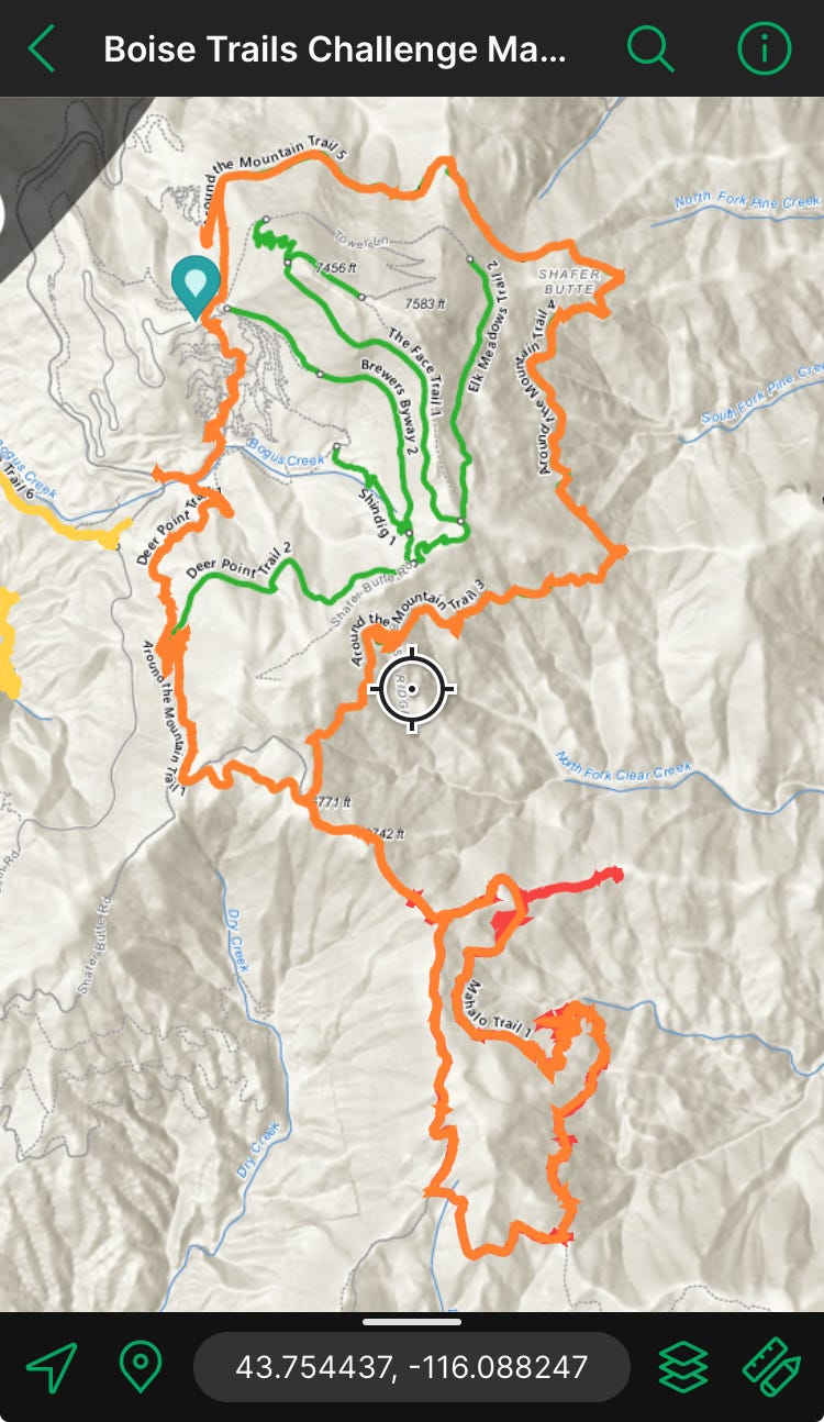
Mahalo trail has much less convenient access. And it doesn’t really connect you to the rest of the Ridge to Rivers system. The actual trail part is only 3.5 miles long, but is really closer to five if you need to get back to where you left your car, and requires at least a mile of the service road. You can’t just pop the trail name into Google Maps and find it. (You can use the coordinates, however. Simply paste “43.744041, -116.085979” into Google for driving directions. Just be prepared for forest road 275, also called Shafer Butte Road.)
The last time I ran Mahalo trail, I avoided driving forest road 275, by making the Mahalo Loop part of a much longer trail excursion. By studying my Ridge to Rivers map ahead of time, I noticed that I could connect Around the Mountain trail with Mahalo. The connecting piece on the primitive road is only about a mile, but Around the Mountain is a one way trail that’s around 6.5 miles (and doesn’t even quite get you all the way around the mountain, ironically) so it’s a pretty substantial bit to tack on to the five-ish mile Mahalo loop.
Yesterday I wanted to see if my minivan could handle driving Shafer Butte Road to Mahalo, and if it could, was the drive worth the trouble?
You know, if you have the time, it’s a beautiful drive. I wouldn’t take any low clearance car, but our Honda Odyssey minivan did just fine. There were only two patches yesterday that still had snow, and I didn’t have to drive over them as other vehicles had already created treads that had dried through them. Most big ruts I was able to navigate around, and the few that I had to drive over, I just took super slow. The entire drive was without incident, and once I arrived at Mahalo, I found several places to park with plenty of space to pull off and not block another vehicle that may be making their way on the service road.
The primitive part of the drive was probably around fifteen minutes each way, which I found to be acceptable for trail access.
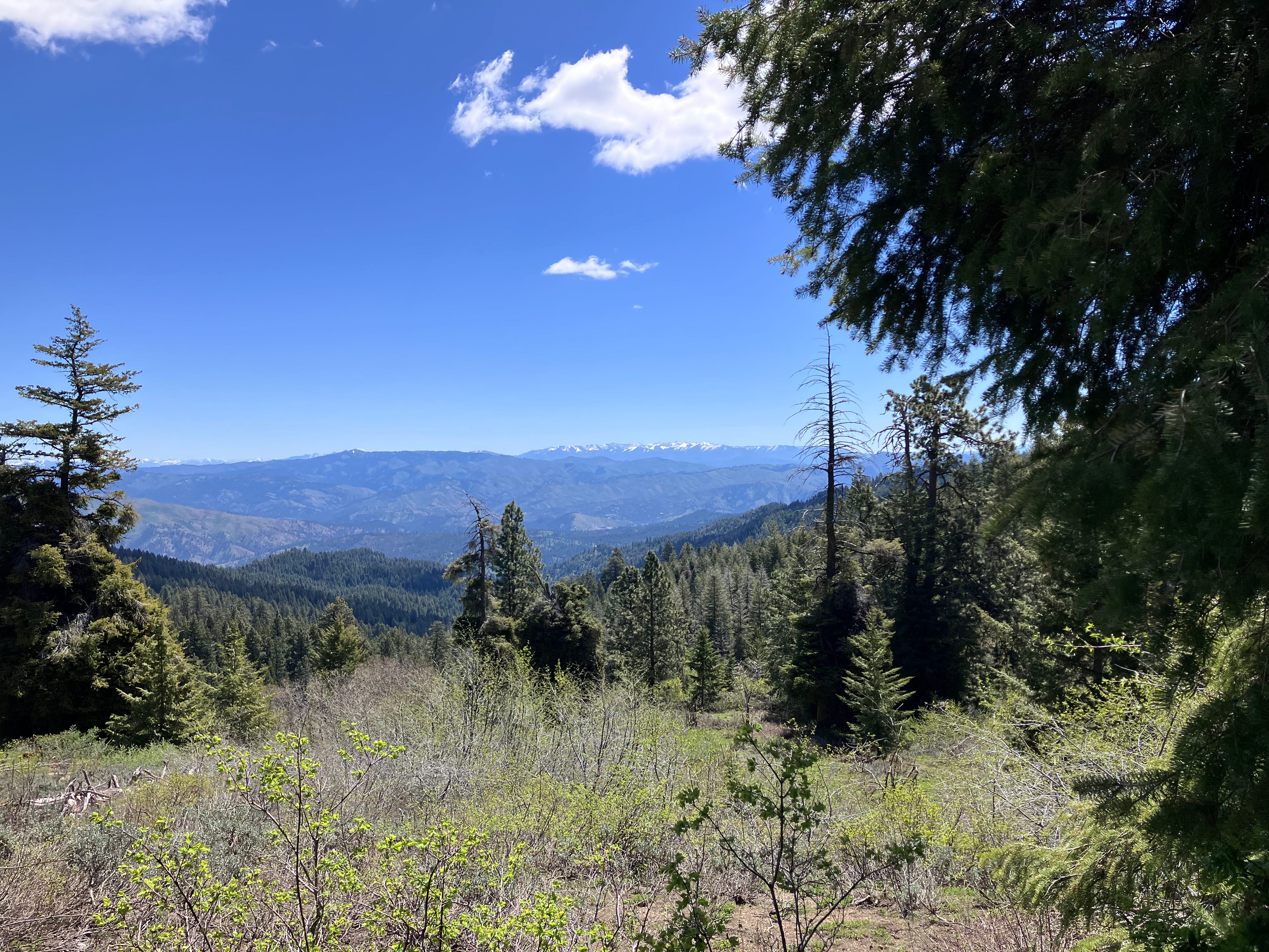
The paved drive up Bogus Basin Road to Shafer Butte Road was a little longer, but on a pretty day, it’s a peaceful and pleasant commute with lots of lovely views.
I would do it again. As long as I have about three and a half hours to spare, that is . . . So not terribly frequently!
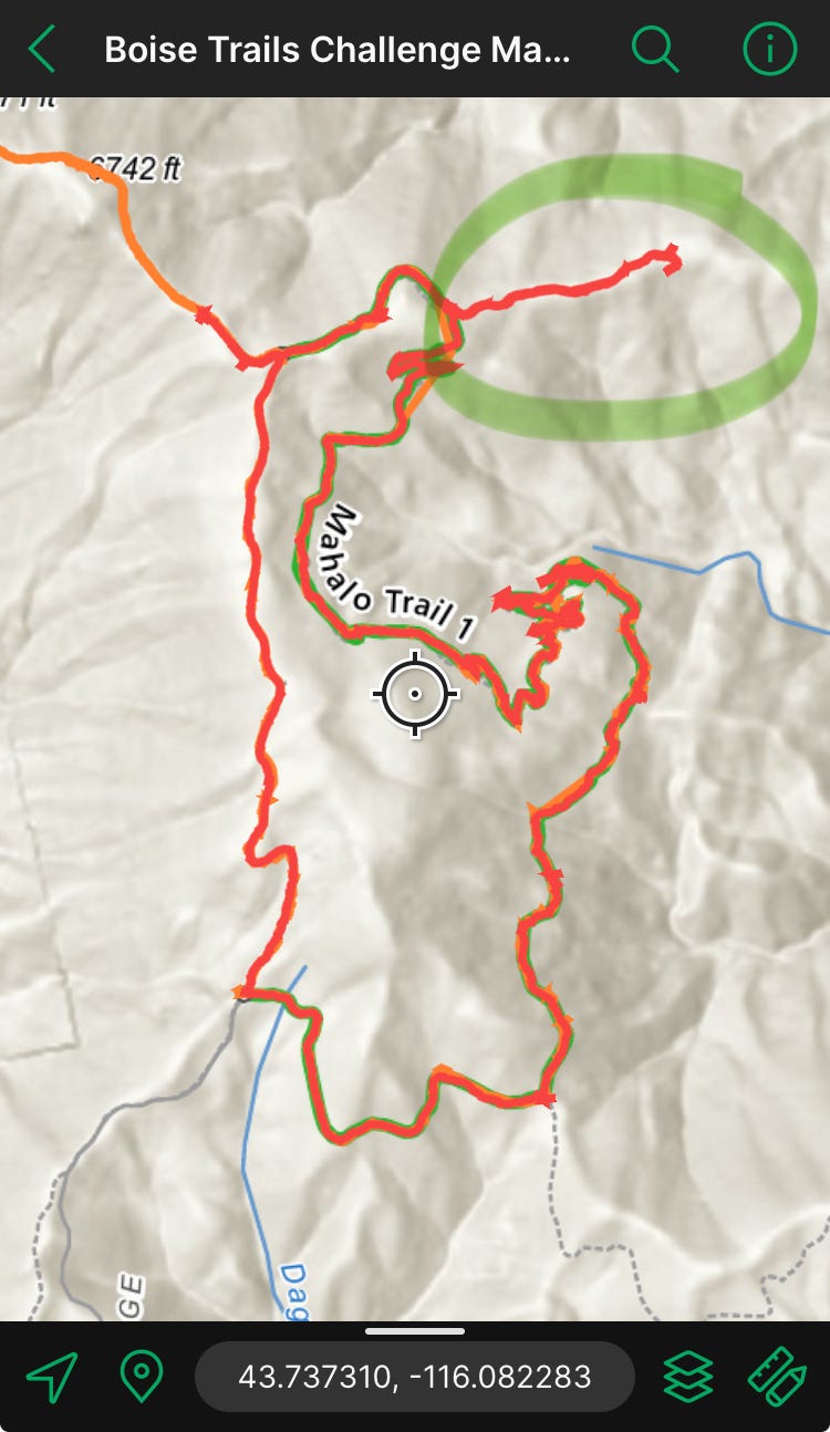
On this excursion, I decided to travel clockwise around Mahalo—the opposite way that I ran it last October.
I like that when you travel a trail in the opposite direction that it often feels “new.” A different season or time of day can make a trail feel fresh too.


Last fall I was definitely not running through snow.
And, there were not this many fallen trees!


Both kinds of obstacles were fun to navigate, but it was the snow that really threw me for a loop. (Or rather, and out-and-back.)
Less than a mile into the mostly downhill route I started thinking, “wow, running Mahalo in the opposite direction really does change the perspective on things. I don’t remember these sections of trail at all!”
It was a good while before I got to a place where the trail wasn’t clear and decided to consult my GPS map.
Ooops.
I backtracked to the place I missed the trail, and found exactly where (and why) I’d gone wrong.
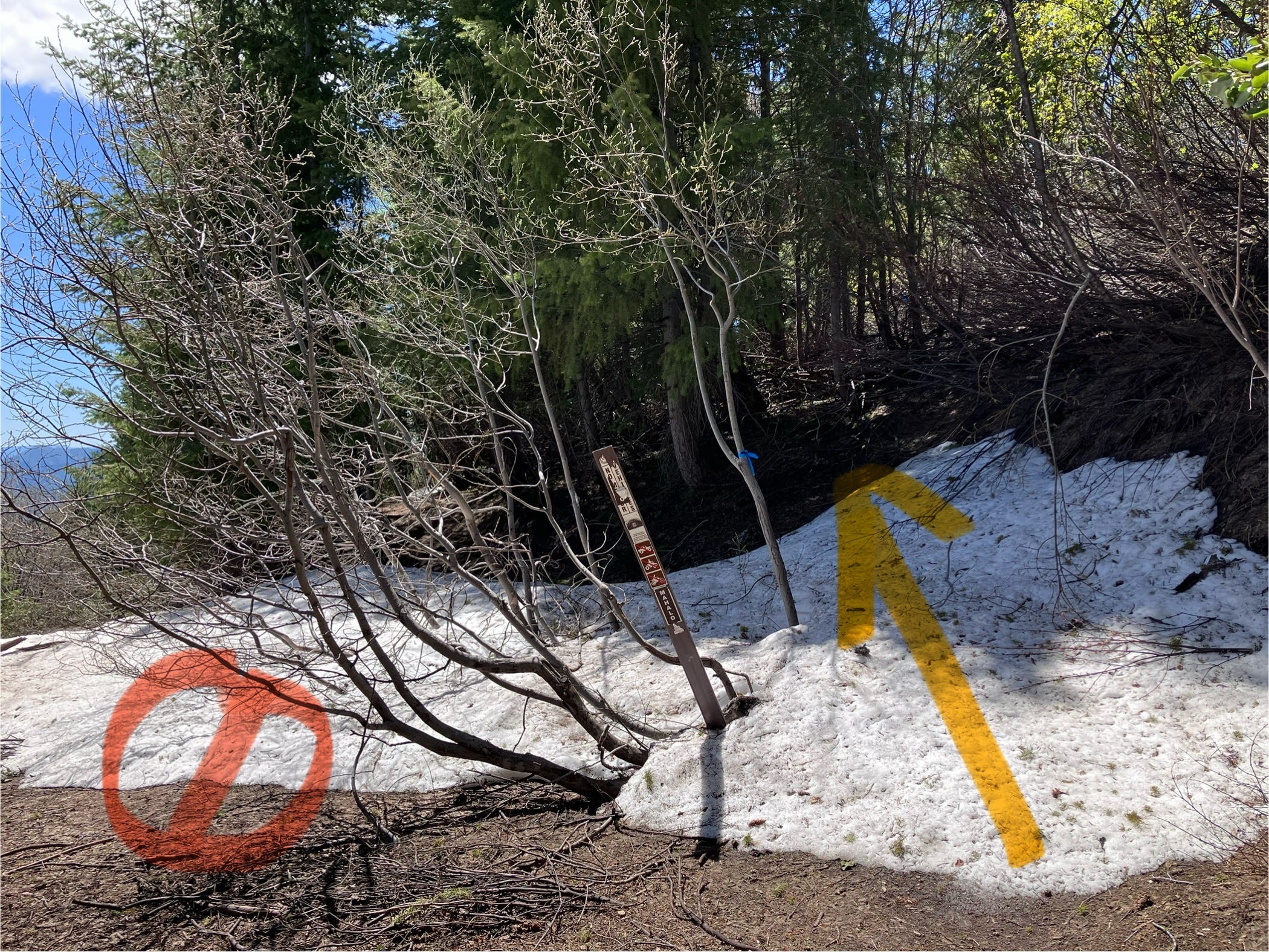
What to me just looked like a snow bank, was actually the entrance to the correct path. The wider more open space to the left, also covered in snow, was another primitive road of some kind, that’s not labeled on my map. It worked until it didn’t! Perhaps a path to be explored at a later date.
The next few times big patches of snow obscured the way, I consulted my phone in real time to stay on Mahalo.
Usually, I’m not “drive 50 minutes each way for a five mile run” kinda girl. (But my little miss on the navigation did push it closer to six miles, so . . .) In this case, however, my running goals were short, my available time was plentiful, and the day was just gorgeous.
This was also an opportunity to figure out if I’d be able to safely drive to Mahalo in the future if needed.
The Boise Trails Challenge is only twenty days away, and so my planning is beginning in earnest.
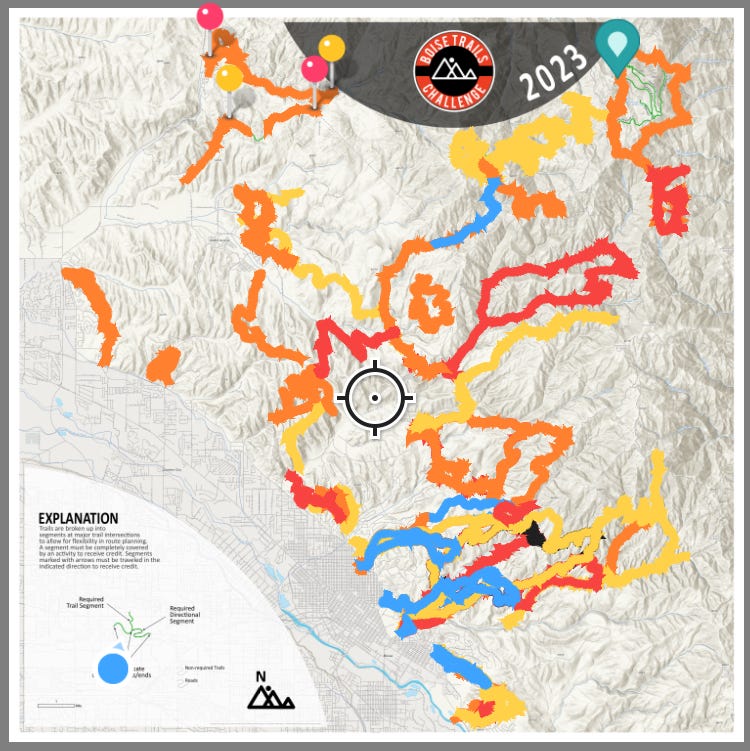
I’ve learned over my almost-year in Boise running the foothills that sometimes getting there is the hard part! The more familiar I am with all of the ways to get there from here, the better I’ll be able to organize my plan of attack come June 20th.
Boise Trails Challenge, here I come!
Wow- sounds like quite the adventure! You go girl!